The North Sea is the shelf sea between Great Britain in the West and continental Europe in the East and South. It has strong tidal movements, and is prone to storm surges that occur when north-westerly winds whip the sea against the continental coast. The most severe surges tend to arise when storms combine with spring tides, during which the sun, moon and earth are all lined up to maximize the gravitational pull on the water. The coastal people have long fought and laboured to protect their lives and their land from the elements. Their history should be of interest to anyone worrying about the best way to adapt to “climate change” or “extreme weather”.
I first encountered the North Sea in 1971, when my parents took all of their six children to spend the summer with relatives on the small North Frisian island of Pellworm. This island is located in the Wadden Sea, off the west coast of Schleswig-Holstein, Germany’s northernmost province.
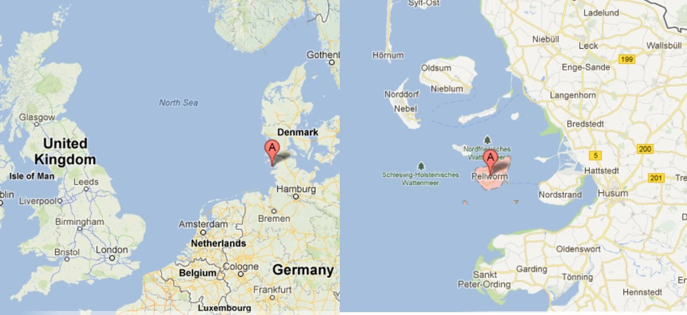
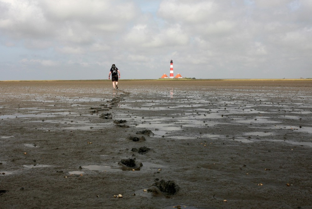
The Wadden Sea is an area of coastal shelf so shallow that the sea floor becomes exposed during every tide of ebb. For several hours, the sea retreats by some 10 kilometres or more, and it then becomes possible to walk across the mudflats from one island to the next. Such walks might be a little scary and sometimes outright dangerous, for the next island may be hours away; the mudflats can turn from firm to swampy quite abruptly, and into some areas, one should not venture without a local guide. However, these walks were also fun; one could catch little fish, crabs and other creatures that were trapped in little pools and puddles left behind by the retreating water.
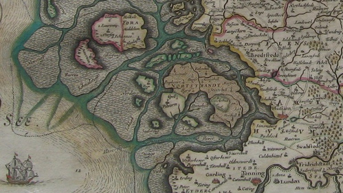
But what I found even more fascinating were the shards and bricks, the teeth and bones, upon which we occasionally stumbled several kilometers from the shore. I learned that these were the remnants of settlements whose inhabitants had perished in a great flood in 1634, and that an earlier flood had taken even more lives and land in 1362. Indeed, these two floods had been only the locally most devastating ones in a long series of storm tides. My father then told us that only nine years earlier, in 1962, a storm tide had killed more than 300 people in the city of Hamburg, where he then used to live and study, and that he had helped to collect the drenched bodies in the aftermath.
These stories of danger and disaster formed a stark contrast to the serene summer landscape, with sheep grazing and dozing right next to gentle waves. However, that the threat was real was plain from the aspect of the coastline fortifications. The entire island of Pellworm, and the continental shoreline as well, were protected by a dike seven meters high. Grass-covered, it had a fairly shallow profile towards the sea, although more steep close to the crown. On the island, this dike had just barely withstood the flood of 1962, and improvements were already underway; in some places, the dike had been elevated another one or two meters and also been given an even shallower and more regular profile, so as to minimize the impact of the onrushing storm waves. Indeed, these new dikes would prove their worth in the even higher flood of 1976; all failures in that flood occured in segments where this modernization had not yet been completed.
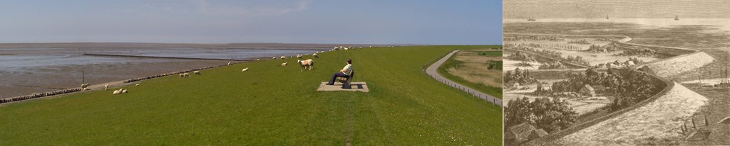
The shoreline was also decorated with breakwaters built from wooden poles and brushwood, which served to slow the tidal movement, promote the deposition of sand and mud, and ultimately reclaim land from the Wadden sea. The process of land reclamation could be seen in its various stages. Saltwort settled on freshly risen banks and aided in their further growth and stabilization. Drainage trenches were dug, and the excavated mud used to further elevate the banks in between, which then became overgrown with grass; the trenches eventually became filled in by further mud deposition to form a continuous area of elevated marsh land. In many places, reclaimed marshes had been surrounded with new sea dikes and turned into farm land.
A little further behind the new sea dike, older dikes were still visible; and the older they were, the lower, steeper and less adequate they seemed. Yet, even these older dikes were still being maintained, and where roads cut through them, wooden barriers were on hand with which to close the gaps in emergencies. Moreover, these dikes were hundreds of years old, and considering that they had been erected by hand, they actually were quite impressive in their own right.
From all this, it was quite clear that coastal protection was, and for a long time had been, taken very seriously. This is also illustrated by historical records, which show how even since the middle ages, dike construction has deeply affected the lives of the hardy Frisians who have been living along the sea shore throughout written history. In those early days, Frisian men were supposed not to travel any further from their homes than allowed them to return the same day, so that they might be ready to defend their land both from the floods and the “heathens” (that is, the Vikings). Every landowner was assigned a stretch of dike for maintenance, in proportion to the size of his land; and an elected Deichgraf (literally, “dike earl”) made sure that this maintenance was properly performed. If a landowner failed to maintain his dike, his property was forfeited and fell to the next person willing to assume those duties; if a person wantonly or negligently caused damage to the dike, their limbs or lives were forfeited as well.
While dike construction and maintenance was initially a local concern, it gradually came to be organized on a larger scale. The observation that dikes time and again failed before the floods, as well as increasing centralization of political power, likely both contributed to this development. Only with this larger scale organization did it become possible to tackle the enclosure of newly reclaimed marshland. Such a project had to be completed in one summer, since the new dike had to be completed before the onset of the next stormy winter season. For one historical construction project, which was carried out about 400 years ago, it has been estimated that more than 500 men toiled for 7 months, 6 days per week, and 14 hours per day, to move 500,000 cubic meters of soil for the erection of 6 kilometres of new dike. (This was hard work. The black, alluvial soil of the marsh land is exceptionally dense and heavy; teams of four Belgian horses used to be put before a single ploughshare on this soil.) Once the earthwork had been completed, the new dike had to be covered with sods of turf, which were fastened to the soil with rye straw; the straw was poked into the soil with several hundred stitches on each square meter.
The engineers who oversaw such projects came very often from the Netherlands. Holland is even more crucially dependent on its coastal defences, since so much of it lies below regular sea level, and the Dutch have always been the acknowledged pioneers and masters of the trade. Indeed, the modern coastal dikes and bulwarks of Holland, from the Zuiderzee works to the Eastern Scheldt dam, are not just impressive but downright magnificent. Bulwarks have been built across the many river arms of the Rhine delta, so as to prevent the surging sea water from pressing into the rivers and flooding the settlements upstream. (Indeed, this is what happened in Hamburg in 1962; that city is 50 km upstream from the estuary of the Elbe river and had not been considered in grave danger from the North Sea storm tides.) Construction of these bulwarks was begun after a disastrous flood in 1953, which broke through the dikes in 89 places and killed more than 1500 people in the country.
Maybe some reader from Holland will find it worth their time to pitch in with a more thorough and substantial description of Dutch coastal management than I could give.
While the floods of 1953 and 1962 claimed approximately 2500 casualties—apart from Holland, England and Belgium were also significantly affected in 1953—the highest flood on record, at least as far as the German coast is concerned, actually occurred in 1976. Nevertheless, damage was minor; clearly, the new construction that had been motivated by those two recent floods worked as planned to protect the coast and its people. With even further enhancements having been made since, nowadays even exceptionally strong storm surges have become uneventful and barely even make the national news anymore.
When I first came from Germany to North America, I was struck by the absence, or near absence, of coastal defences in New York and many other places. How could people have been so imprudent? It may simply have arisen as a consequence of immigration—most immigrants to those coastal cities probably came from landlocked places in Europe, and therefore lacked the sense of danger that has become second nature to the indigenous people of the North Sea coast.
So is there a morale to this story? Maybe this one: When confronted with rising seas, don’t belabour “extreme weather”—instead, get in touch with some Dutch engineers ASAP.
This post appeared first at Watts Up With That? in 2013.